At ENP, we get excited about maps and data. We believe that in order to love your neighbors and your neighborhood, you have to know them. This includes data that tells a bigger story of the trends of each neighborhood, as well as individual, personal stories that data cannot capture.
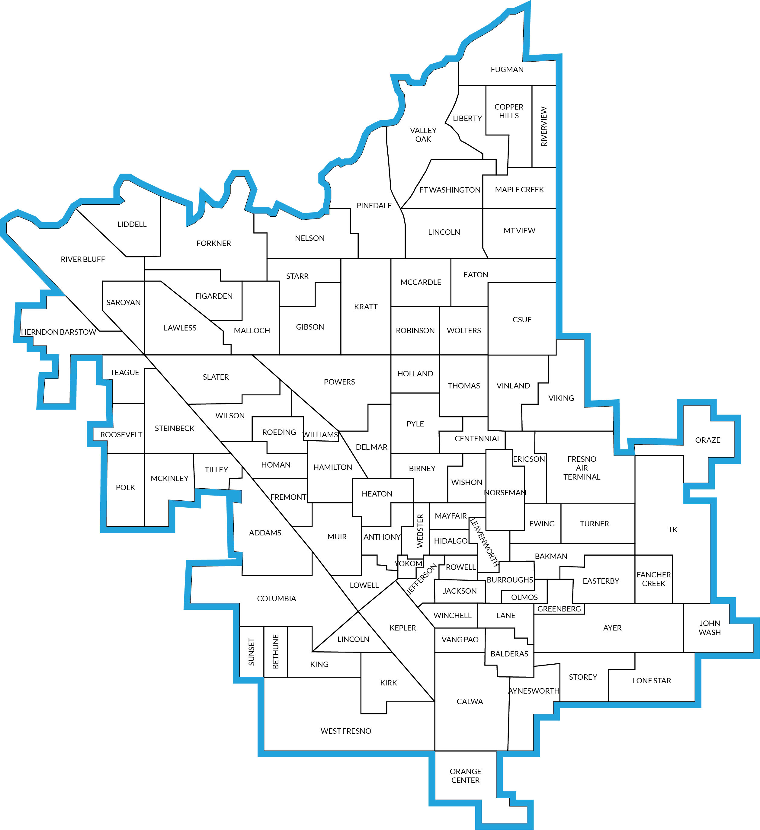
ENP has created data sheets of Fresno neighborhoods as a resource for churches and community partners who want to learn more about their neighborhoods so they can make informed decisions and take relevant action steps. We focus on neighborhoods as they are defined by elementary school zones, for a total of 92 neighborhoods in the City of Fresno.
Here are a few examples of data sheets based on elementary school neighborhoods in Fresno where ENP is involved.
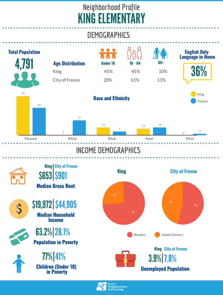
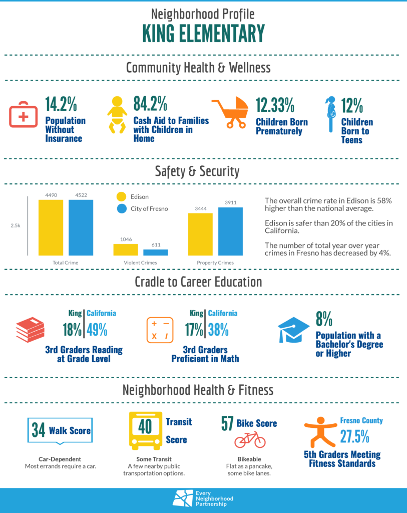
If you would like a data sheet of one of the following neighborhoods, email gabrielle@everyneighborhood.org your requested neighborhood sheet. Other neighborhoods beyond this list are also available upon request.
- Addams
- Bakman
- Birney
- Calwa
- Jackson
- King
- Lincoln (Fresno)
- Webster
- Winchell
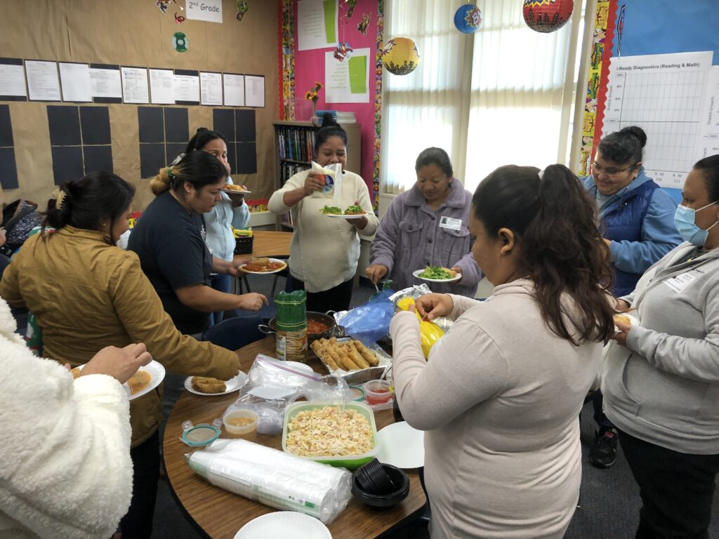
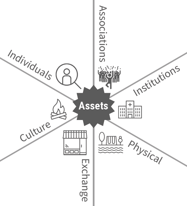
These data sheets are just one tool that can be used to create a neighborhood profile as you get to know your neighborhood. Other elements or assets to consider that make up a neighborhood of interest include things like physical structures and elements, local businesses and organizations, local churches, community groups, individual people with various passions, skills, and networks, and more. Consider the various assets of your neighborhood alongside data to develop a more thorough picture of your neighborhood. Get to know all the elements of your neighborhood and the people who make it up and allow that information to shape your involvement in a community.
Additional Maps and Links:
- ENP Maps
- Tools Used in ENP Data Sheet
- Asset Based Community Development and How Organizations Implement It for Neighborhood Transformation
- Social Capital and Economic Mobility
- Mapping Inequality
- Rare Maps Reveal Fresno’s Overlooked History Of Segregation
- Segregated By Design
- How dividing US cities along racial lines led to an air pollution crisis 100 years
- Displacement and Concentration of Low Income
If you are interested in ENP providing a “Mapping Your Hood” workshop to your church or organization so you can learn more about data and how to create your own data sheets, email gabrielle@everyneighborhood.org.



Leave a Reply